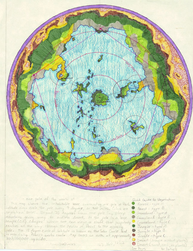
|
This is the first incarnation of Pearl, a few things have changed since this
was drawn. If you're really curious, you can take a 56K detour and take a
look at a cleaned-up copy of this map. Also
don't miss the use of this map as part of a Bryce 1 texture in the image
Pearl And Moons.
Two major changes:
- Along the 12 o'clock line, the small unnamed island is actually the
island of Karishikar, but in this map it is totally the wrong shape and not
quite in the right place.
- Down around 4 o'clock, the entire island-continent of Azuti was swallowed
up into the Vortex Ocean.
Some name changes:
- The peninsula labelled Minaran is a portion of a nation named
Minara. The nation of Minara extends well onto the mainland,
so this psuedo-pod of land is refered to as the Minaran Peninsula.
- Kazoti is now called Ishkarinda.
- Cabochon is now called Sinit.
The light blue areas of course are oceans. The other colored areas indicate
types of vegetation and climate. The red concentric circles are lines of
latitude marked every 9 degrees. The circle at 18 degrees is the Solar Circle,
inside of which will experience sunlight continuosly for half of the year and
then will be dark the other half of the year.
|